catchment areas

The Avon basin covers much of the Western Australian wheatbelt and includes various sub-catchments and tributaries.
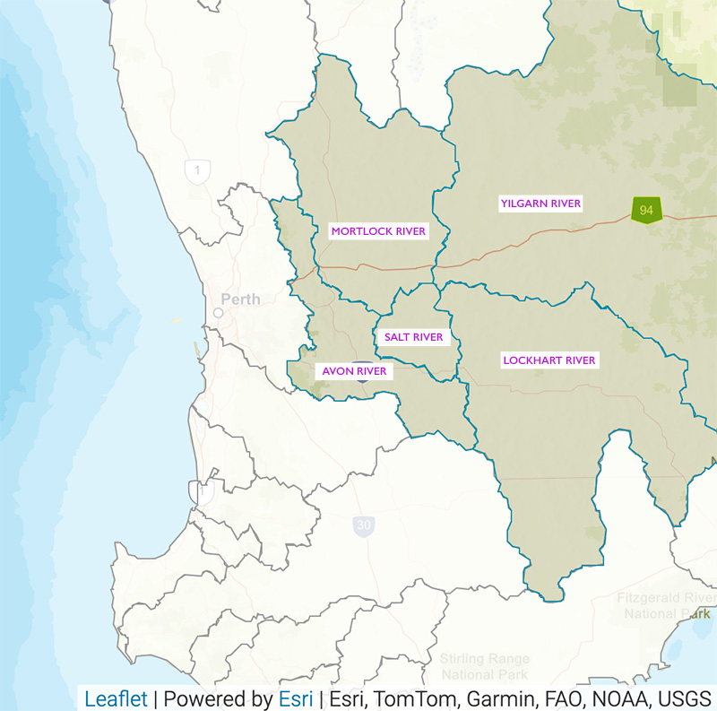
There are 5 major catchment areas of the Avon River:
The Avon basin covers about 120,000 km2. Map source: rivers.dwer.wa.gov.au
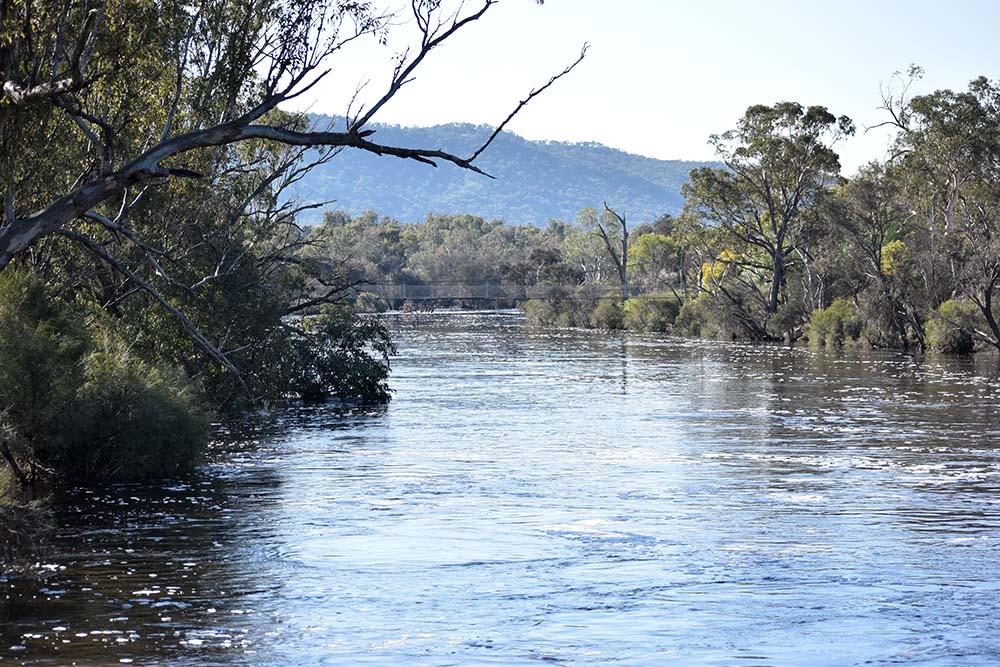
A suspension foot bridge with steel cables and timber decking spans the Avon River in York, Western Australia.
Upper Avon River
- Location: This area is located in the eastern part of the catchment, originating within the Shire of Wickepin.
- Features: Characterised by undulating terrain and a mix of native vegetation and agricultural lands.
- Tributaries: Includes smaller streams and tributaries that feed into the Avon River.
The Yealering Lakes section of the Upper Avon River covers the reach from Squires Rd upstream to the confluence of Walellemining Brook, Cuneenying Brook and Yarling Brook. This confluence is where the Avon River starts, however locally it is considered to start from Lake Yealering, approximately 10 km downstream (Viv Read & Associates, 2006).
Tributaries to this section have some wonderful names and include:
- Wondering Creek North;
- Woyerling Creek South;
- Bindermucking Gully;
- Woodebulling Brook;
- Tanlarmerling Gully;
- Walellemining Brook
- Wogalin Gully
- Boyning Gully
- Cuneenying Brook and
- Yarling Brook (Viv Read & Associates 2006b).
From Nonalling Lakes it heads west into the Shire of Pingelly before turning north again. Crossing back into the Corrigin Shire it picks up outflow from Bindermucking Gully then heads west back into the Pingelly Shire, where Woyerling Creek South enters as it turns north again. Woyerling Creek North enters the system here and shortly after Dwarlacking Creek enters the river from the west.
A River Recovery Plan was developed for this section, and the planning was undertaken in 2005. It was prepared by Viv Read & Associates for the Department of Water and the Avon Waterways Committee.
Following on from where Dwarlacking Creek entered the river it heads north-west into Dwarlacking, Little Dwarlacking and Stock Pools. From Stock Pool it heads north into the Shire of Brookton then north-west past the small townsite of Kweda and into Quandadine Pool and then Dwardadine Pool.
The river then continues in a westerly direction, past the small town of Aldersyde where Sandplain Creek enters the system, and it crosses Aldersyde Road and into Neuralgin Pool, where the Avon River Training Scheme terminated.
Shortly after Neuralgin Pool the river again turns north, through Beardlucking Pool, heads north-west again, through Bullrush Pool, then in a more northerly direction to Boyagarra Pool and on into the Shire of Beverley. A short distance below Boyagarra Pool is the Qualandary Crossing, the outlet of Yenyening Lakes and the Salt River; the distance from Squires Road to here is 60km.
Boyagarra Pool is around 600m in length. A ‘Friends of Boyagerra Pool’ have undertaken revegetation and restoration work along the banks, floodplain and the land adjoining the Pool.
The catchment area upstream of the confluence with the Salt River at Yenyening Lakes is 3,200 km2.
A River Recovery Plan for this section was again undertaken in 2005 and prepared by Viv Read & Associates for the Department of Water and the Avon Waterways Committee.
Pelham Brook – Toodyay
Pelham Brook is a small sub-catchment in the Shire of Toodyay, entering the Avon River in the Toodyay townsite. Its headwaters are in Pelham Reserve, a York gum-jam and wandoo woodland to the south and above the town.
In 1900, a ‘million gallon reservoir was excavated high on the hill slope above the town’ (Erickson, R. Old Toodyay and Newcastle Toodyay Shire Council 1974) for the town water supply, being fed by water from Pelham Brook; it was not filled until the winter rains of 1901.
When a branch from the Goldfields pipeline reached Newcastle (Toodyay) in 1908 the reservoir was decommissioned; it was at first used as the town’s swimming pool but gradually filled with sediment and virtually forgotten.
During World War II a bunker complex was constructed near the reservoir and a revetment spillway built to re-direct the flow from the reservoir and the bunkers back into the Pelham Brook watercourse behind the convict era Gaol.
From this point the Brook has had its course altered extensively. The Standard Gauge Railway, completed in 1968, provided a significant barrier to the Brook’s original course to the Avon River. A large culvert was built under the line directing water from the Brook towards the river. The culvert was buried, with its outlet behind Saint Stephens Anglican Church running directly into the riparian vegetation of the river.
BOYAGERRING BROOK – Toodyay
Boyagerring Brook is a small sub-catchment in the Shire of Toodyay, entering the Avon River in the town of Toodyay. Its headwaters are in the east of the Shire commencing on farmland in the Nunile area.
It passes close to the Toodyay Recreation Centre and the Toodyay District High School (TDHS) before its confluence with the Avon River west of the school footbridge.
The Brook was noted by George Fletcher Moore in 1836 where local Aboriginals called it Boiagering (Erickson, R. Old Toodyay and Newcastle Toodyay Shire Council 1974 p.24) or “Boiagaring – Aboriginal for a deep spring with pitfalls for kangaroos …” (Moore, GF.1836a. Recent Tour to the Eastward and Northward of Northam, June 1836 Perth Gazette, 18 June 1836).
The River Recovery Plan for Section 3 (Water and Rivers Commission and Avon River Management Authority 1999, River Recovery Plan, Section 3 -Toodyay, River Recovery Plan Series No RRP 1) identified the Brook as a high priority and that management planning to minimise nutrient loss from agricultural land needed to be undertaken.
Anecdotal evidence suggests it is a significant sediment source to the Avon River.
Malkup Brook – Julimar, Toodyay
Malkup Brook is a small tributary of the Avon River in the west of the Toodyay Shire in the Julimar area. It begins in the Julimar State Forest with a number of branches contributing to the main stream channel. As it continues its way towards the river it passes through the subdivision of Julimar Springs before entering the river between Long and Cobbler Pools, near Billy’s Hill Crossing.
Anecdotal evidence suggests fresh-water inflow from some tributaries. An area in the headwaters is subject to salinity and acidity.
The Brook passes through Crown Reserve 34308 in the Julimar Springs subdivision. This 35 ha reserve ‘made up of three linear sections of 8.7 ha, 23.7 ha and 2 ha beginning near Julimar Road and running in a south eastern direction along the banks and flood plain of Malkup Brook’ was the subject of a World Wide Fund (WWF) Demonstration Site.
Malkup Brook Reserve is located within the Southwest Australia Ecoregion (SWAE), an area stretching from Shark Bay in the north-west to beyond Esperance in the south-east.
The area is internationally recognised as a globally significant hotspot for flora and fauna conservation due to its high number of unique species and habitat types and the on-going threats to their survival.
Within the SWAE, a focus area with particular conservation value has been identified around the Julimar State Forest and Bindoon Defence Training Area, which when combined with bushland in the adjacent landscape (within an approximate 15 km radius), represents a significant conservation asset.
For the purposes of WWF’s demonstration project, this is known as the SWAE Demonstration Area.
Within this area, WWF-Australia, supported by the Australian Government’s ‘Caring for our Country’ program aims to bring ‘systematic conservation planning’ efforts to life by working on-site with individual land managers. This project demonstrates potential achievements in practical terms within a defined geographical area.
In 2011 a comprehensive macro-invertebrate and herpetofauna ‘Fauna Inventory Survey’ of Malkup Brook Reserve4 was undertaken for WWF by David Knowles/Spineless Wonders.
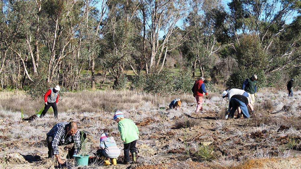
Toodyay Friends of the River (TFOR) members have assisted with revegetation at Malkup Brook Reserve and the Seed Orchard Group grew tubestock for the WWF project.
Mortlock River
- Location: Situated to the north of the Avon River, encompassing the towns of Cunderdin and Goomalling.
- Features: A significant contributor to the Avon River, with extensive agricultural areas primarily used for wheat and sheep farming.
- Tributaries: The Mortlock River is divided into two main branches, the Mortlock River North and Mortlock River East, both of which converge before joining the Avon River.
The north, south and east branches of the Mortlock River system drain into the Mortlock River, which flows west to join the Avon River at Northam. The main tributaries are:
- Mortlock River North Branch;
- Muluckine Creek;
- Grass Valley Brook;
- Meenaar South Creek;
- Mortlock River South Branch; and
- Mortlock River East Branch
Mortlock River North Branch
The Mortlock River North originates in the north of the Avon River basin. Drainage in the upper part of the catchment is characterised by a series of salt lakes, including Lake Ninan and Lake Hinds. In the lower catchment the main channel is well defined.
The north branch flows into the Mortlock River near the confluence with the Avon River at Northam. Tributaries downstream of Lake Hinds include:
- Mallabine Creek;
- Jennapullin Brook;
- Chitibin Brook;
- Yarramony Brook;
- Cunjardine River;
- Bollonine Brook;
- Bebakine Creek;
- Cockerding Brook;
- Woormenning Gully;
- Burabadji Creek;
- Elyaring Brook;
- Gabbyquoiquoi Creek;
- Kalguddering Creek;
- Gratton Creek; and
- Mortlock Creek
Mortlock River South Branch
The south branch originates near Belmunging and flows north-west to join the Mortlock River at the Mortlock East confluence. The main tributaries are:
- Melbong Brook;
- Coonanining Gully;
- Quailing Gully; and
- Cat Gully
Mortlock River East Branch
The east branch of the Mortlock River originates in the north of the Avon River basin. Drainage in the upper catchment is characterised by a series of salt lakes, including Lake Wallambin and Cowcowing Lakes.
In the lower catchment the main channel is well defined. The main tributaries are:
- Kelkering Creek;
- Tomalockin Creek;
- Youndegin Creek;
- Warrengidging Brook; and
- Bungulla Creek;
Salt River
- Location: The Salt River is in the ‘Zone of Ancient Drainage and connects the Yilgarn-Lockhart Rivers through the Yenyening Lakes to Qualandary Crossing and the Avon River. It is in the Zone of Ancient Drainage and at its outlet it connects to the Zone of Rejuvenated Drainage.
- Features:
- provides a rich natural heritage and support a large suite of plants and habitat for many species of birds, including migratory.
- retains heritage, social, economic and environmental values, even in the face of the degradation resulting from increasing salinity and waterlogging levels.
- Tributaries:
All of the major tributaries have gradients that far exceed that of the Salt River. When these reach the broad, flat floodplain they tend to spread out through shallow undefined channels causing localised ponding. The main tributaries are: South Yoting Creek, Unnamed (near Badjalin), Warralling Creek, Dorakin Gully, Conallan Gully, Hommajelly Gully.
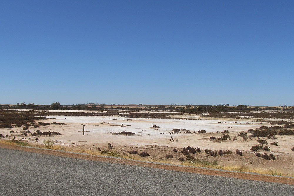
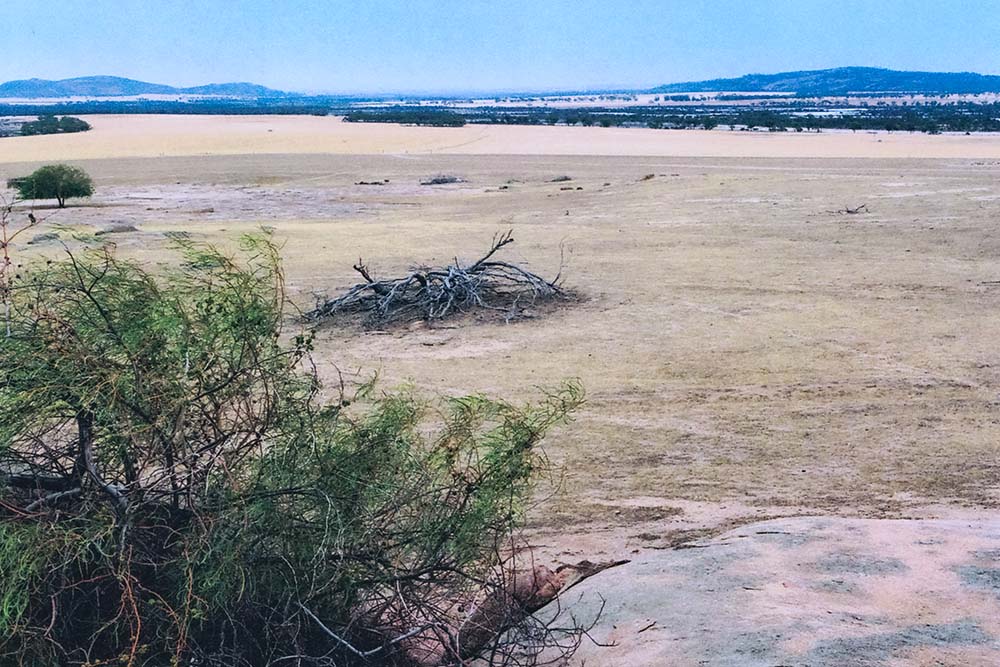
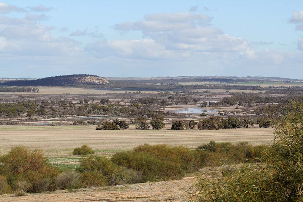
The nature of the landscape of the Salt River is ‘characterised by broad, flat valley floors linked by chains of salt lakes and long, gently sloped valley sides punctuated by rocky outcrops that rise to an undulating sandplain, the last remnants of the lateritic profile that once covered the entire landscape’.
The river then heads west – between Mt. Caroline to the north and Mt. Stirling to the south, touching the Shire of Tammin before entering the Shire of Quairading.
It passes through the Moullen Nature Reserve (NR) then takes a turn south (over Mount Stirling Road), through the Badjaling North NR and into the Shire of Bruce Rock, the Badjaling NR and past Badjaling itself. South Yoting Creek enters the system here where the river then begins to turn south-west before crossing the Quairading-Corrigin Road. The fall from Glenluce Road where the Salt River commences through to the Quairading-Corrigin Road is 10.4 metres over 40 kilometres (a gradient of 0.26 m/km).
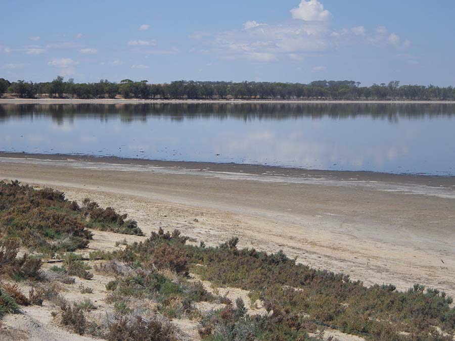
Lake Yenyening is the start of the Yenyening Lakes chain (connected upstream to the Salt River). Lake Yenyening is the most prominent of the lakes and is located about 5km from the Quairading-Corrigin Road. The lakes traverse the Shires of Quairading, Brookton and Beverley.
It has been perceived that this (and other waterways in the Zone of Ancient Drainage) has little value. Contrary to this they provide a rich natural heritage and support a large suite of plants and habitat for many species of birds, including migratory.
Qualandary Crossing is approximately 209.06m AHD and Caroline Gap, around 70 km upstream, is 226 AHD. This is a drop of just 17 metres, or less than 18.5cm per km. The gradient across the Yenyening Lakes from the Quairading-Corrigin Road (just under 220m AHD) in a direct line to the outlet some 33 km away is less than 3in 10,000.
There is a perception in some parts of the community that these waterways have little value; however, many people – the traditional owners, scientists, conservationists and landholders included – appreciate the fact that these waterways retain heritage, social, economic and environmental values, even in the face of the degradation resulting from increasing salinity and waterlogging levels. However current waterway condition needs to improved, or at least maintained, for these values to continue in the face of increasing degradation.
The key management issues in the Salt River floodplain are:
- increasing salinity and waterlogging in the valley floor
- loss of riparian vegetation fringing the Salt River and its tributaries
- management of flood flows
- impedance of flood flows by road crossings
- increased stream flow causing erosion and sedimentation in tributaries
- pest species degrading riparian vegetation
- lack of corridors linking areas of remnant vegetation
- fire risk
- dumping of rubbish in floodplain areas
Of these, the most crucial are increasing salinity levels and waterlogging in the valley floor. These are processes that need to be managed at a catchment scale, through partnerships between landholders, all levels of government and non-government agencies.
Salt River drainage floor
Consists of the drainage floor, and associated saline plains, minor sandy ridges, drainage lines and small ill-defined lakes down-stream from the Corrigin-Quairading road. This sub-system is subject to frequent inundation, and has shallow freely available groundwater, overlying deeper paleochannel aquifers. The saline plains support a saltbush, samphire and bluebush shrubland that is grazed intermittently, with a ti-tree shrubland on areas with slightly more relief. This land is nearly all privately held.
Lakes and channels
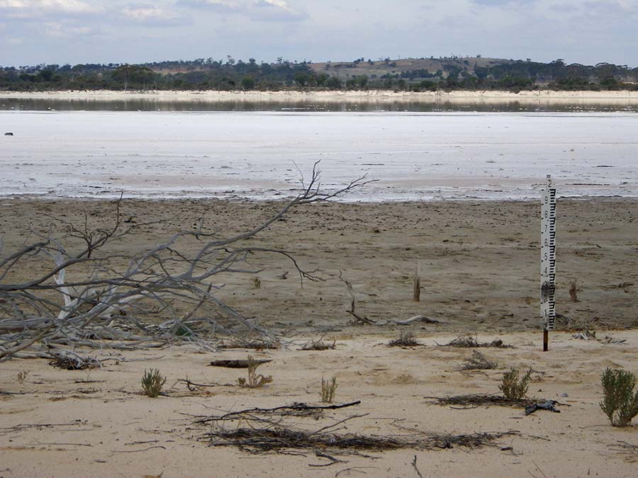
Consists of the large well defined lakes, sandy banks, channels and drainage lines that occur up stream from the Qualandary Crossing. The bare lake beds are separated by well vegetated sandy banks and rises supporting mallee and ti-tree shrublands, with occasional stands of York gum. Much of this land is held in two nature reserves – Reserve 31837 and Reserve 28088, which are vested with the Conservation Commission of Western Australia.
At the western extremity of the Yenyening Lake system is the Qualandary Crossing. At this point the Zone of Ancient Drainage discharges (through a set of gates constructed in 1998) into the zone of rejuvenated drainage,iii and – when the gates are opened – the Avon River during periods of moderate flow or above.
The water held back by the crossing is used for environmental purposes (local biodiversity and waterbird habitat); flow regulation (to manage downstream flood risk); and recreation (water sport and other recreation).
The references mentioned below are recommended reading to gain a greater understanding of the trials our Avon River undertakes before reaching Toodyay.
Yilgarn River
- Location: Originates from north-east of Southern Cross from water draining into Lake Seabrook.
- Features: The Yilgarn River has its origins almost as far east as Coolgardie north east of Southern Cross in the Zone of Ancient Drainage. ‘Yilgarn’ is the Aboriginal name for ‘white stone’ or quartz. It contributes 4GL of flow into the Avon Catchment.
- Tributaries: Tributaries of the Lower Yilgarn River are: Minkadine Creek, Nareling Gully, Mooranoppin Creek, Wallatin Creek and the Belka River.
The Yilgarn River catchment is approximately 55,9002km in extent and is the largest of the sub-catchments. It originates from north-east of Southern Cross from water draining into Lake Seabrook.
The fall from the top of Lake Deborah East to Caroline Gap is 91 metres over a distance of around 270km, which is approximately 2.97 metres/km (compare Mt Eliza/Kings Park in Perth city at 103 metres above the Swan River to the 91 metre fall in the Yilgarn River system).
Its eastern extremity is approximately 130km from Coolgardie. A chain of salt lakes commence around Boorabbin and Yellowdine, draining west through Lake Eva and through almost flat terrain to Lake Seabrook. These salt lakes continue south west and are further fed by salt lakes from the north and south east of Southern Cross. Lake Seabrook feeds into Lake Deborah East (after crossing the Koolyanobbing-Southern Cross Road), Lake Deborah West and then Lake Baladjie (and the Lake Baladjie Nature Reserve).
After crossing the Koorda-Bullfinch Road the system drains into Lake Campion and Lake Brown. It is here, where the Mulka River (draining from north of Lake Brown) enters the system and where the Yilgarn River attains its status.
After crossing the Merredin-Nungarin Road the Yilgarn River heads south through Nangeenan Gully where Bulluguttin Creek, the Belka River (draining from south west from Merredin) and Wallatin Creek enter the system. Heading south west the river picks up Mooronoppin Creek before heading past the town of Kellerberrin where it picks up Nareling Gully and Minkadine Creek, and then finally makes its confluence with the Lockhart and Salt Rivers, at Caroline Gap.
Lockhart River
- Location: The Lockhart River commences in the south-eastern region of the catchment, near Lake King
- Features: The Lockhart River is in the Zone of Ancient Drainage; it contributes 13GL of flow into the Avon River system.
- Tributaries:
- Lake King Branch: Camm River; Dadenning Creek; Lockwood Gully and Youablin Creek
- Lake Grace Branch: Pingrup River; Chinocup Creek; Minelup Creek; Deep Creek and Pinchin Gully
The Lockhart River Sub-catchment has an area of 32,400km2 with a gradient or fall calculated at 24cm/km from the top to the bottom; over a distance of 170km the fall is only 41m . It contributes 13GL of flow into the Avon River system, over three times that of the Yilgarn sub-catchment.
The Lake King branch is the most eastern catchment of the Lockhart system, where a chain of salt lakes wend their way westward. They include Lake Pallarup, Lake Milarup, Lake King, Lake Camm (and Lake Kathleen), Lake Fox, Lake Gulson, Lake Varley, Lake Hurlstone and Lake Carmody.
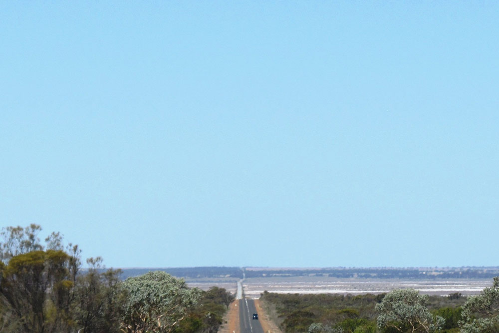
When approaching Lake King, the Newdegate/Ravensthorpe Road crosses a spectacular 10km long Salt Lake Causeway, the longest road in WA built across salt lakes (see photo).
The Camm River drains west from Lake Carmody, past Hyden then makes a slight turn South-South-West, where it joins up with the Lockhart River, downstream of Jilakin Lake.
Studies in 2008/2009 indicate salinity in the Lockhart River to be similar to that of sea water and is the highest in Western Australia.
The Lake Grace branch originates south of Lake Grace and Newdegate. Also within this sub-catchment the Pingrup River rises, in the salt lake chain south of Chinocup Lake. As it flows north it picks up Minelup and Deep Creeks before flowing into Lake Grace South and Lake Grace North, then passing the town of Lake Grace. At this point Pinchin Gully enters before crossing the North Lake Grace – Karlgarin Road.
Continuing further north, the Pingrup River enters the southern part of the Lockhart River, just east of Jilikin Lake.
The Lake Grace sub-catchment is separated from the Lake King sub-catchment by the Magenta Internal Catchment, all within the Zone of Ancient Drainage’ .
The southern leg of the Lockhart River has its own story. Originating in the Magenta Internal Catchment this 1102 km ephemeral salt lake is located in the A Class Lake Magenta Nature Reserve . In large flood events it may drain south into the Fitzgerald River catchment and in extreme events can drain north into Lake Noonan and Lake Stubbs, and the Lockhart River in the Lake Grace sub-catchment. It is internally draining in most years.
Check out our projects
Discover the incredible impact of TFOR projects and join us in our mission to restore the Avon River ecosystem for future generations.

