


Avon River Management
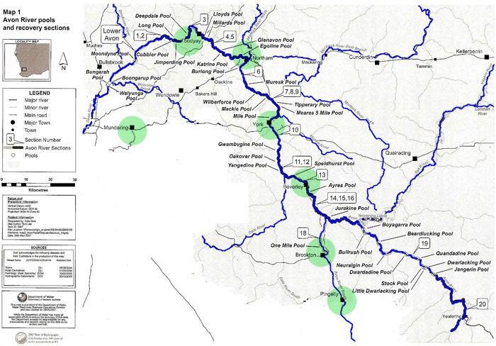
The darker blue line from Section 20 (lower right of the map) downstream through Beverley, York, Northam and Toodyay to
Section 1/2 (upper left of the map) is the main channel of the river. Page updated 15th May 2020
The numbers in the boxes (e.g. Sections
1 & 2, - 3,
4 & 5, 6,
etc) relate to the
River Recovery Plans , found under River Management.
The Yilgarn River originates from Lake Seabrook and Lake Deborah, north-east of Southern Cross. The Lockhart River originates at Lake Magenta, south of
Newdegate. After the confluence (junction) of these two rivers (at Caroline Gap, just south of Kellerberrin - top right on the map) it becomes the Salt River,
which in turn enters a chain of lakes (the Yenyening Lakes). These enter the Avon River north of Boyagarra Pool, at the Qualandary Crossing, east of Beverley.
The catchment flowing into the Avon at this point is 91,000 square kilometres.
Monitoring Overview
River Vegetation
Birds & Wildlife
Weeds & Feral Animals
River Health